

MÁLAGA – Finally a National Park in the western sierras of Andalusia, a hot spot of plant diversity.
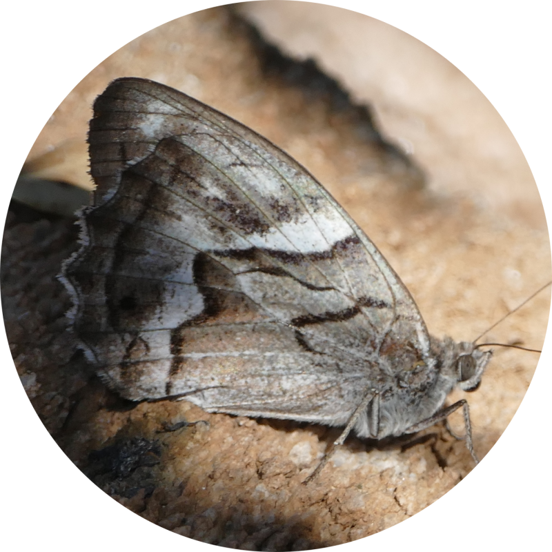
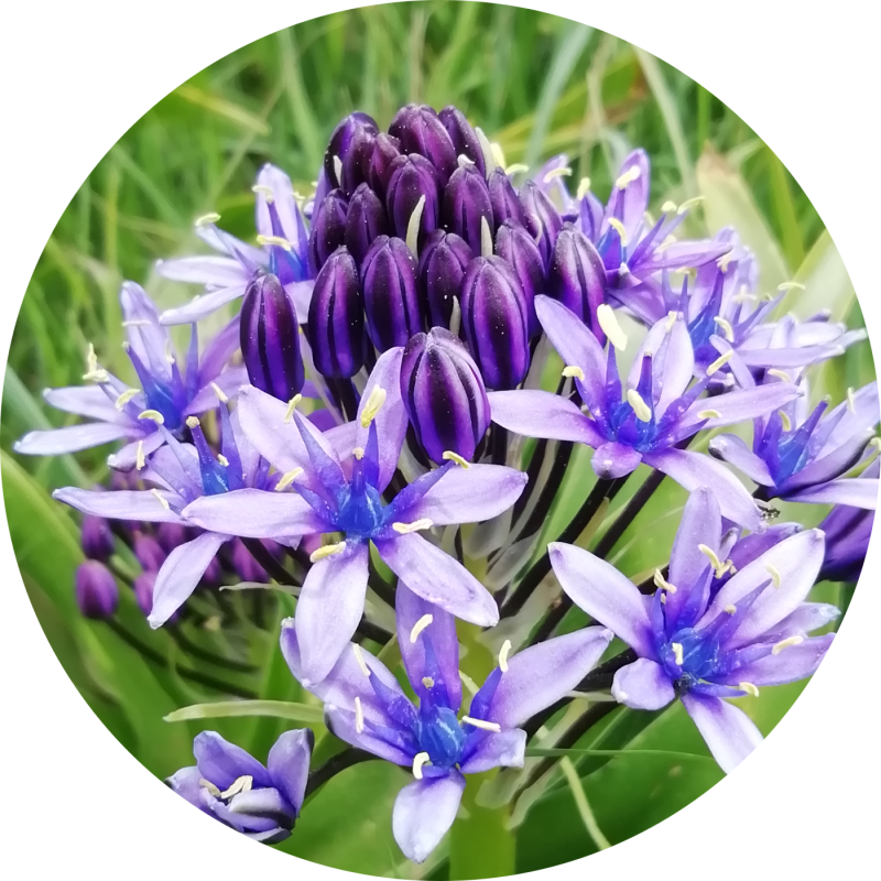
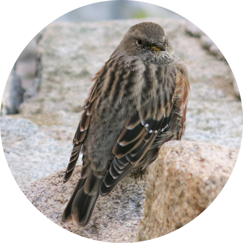

Sierra de Las Nieves, the name of a natural park, a region and a mountain, is located in the province of Malaga, southeast of Ronda, north of Marbella and west of Yunquera (on the road from Ronda to Malaga). Its 1,919-meter-high summit, known as Pico Torrecilla, is the highest point of the Western Betic Mountain Range.
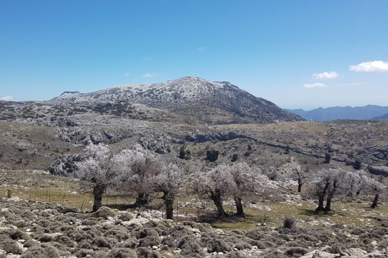
As its name indicates, Sierra de Las Nieves is the sister mountain of Sierra Nevada, which is covered with snow and frost in winter. It is also the white mountain of limestone rocks that give rise to magnificent small rivers: Rio Guadalevín, Rio Grande, Rio Genal, Rio Polecat and Rio Verde. A huge limestone mass that offers dazzling karst formations, such as the cliffs of the Tajo de la Caína or the well of the Sima GEM (-1 022 meters), the deepest in Andalusia.
- Mediterranean high mountain
- Limestone saw
- Pinsapos
- High altitude pasture
- Panoramas and mountaineering
Introduction: A Paradise for Hiking and Nature
In the heart of the province of Malaga, where the Betic Mountain Range unfolds with its most emblematic peaks, is the Sierra de las Nieves National Park, a protected area that invites you to a total immersion experience in nature.
Declared a National Park in 2021, this territory of more than 23,000 hectares represents the culmination of centuries of conservation efforts and is home to landscapes, ecosystems and species that are unique in the world.
Here, hiking becomes a journey through time, from the forests of pinsapo, authentic living fossils, to the karst peaks that exceed 1,900 meters, where the silence is only broken by the singing of birds and the murmur of the wind.
It is an ideal destination for those seeking to connect with the purest essence of the Mediterranean mountains, discover its exceptional biodiversity and hike trails through spectacular geology and a rich and deep-rooted cultural history.
The Natural Essence: Why is it a National Park?
The Sierra de las Nieves is not only a beautiful natural space; it is an enclave of exceptional ecological value at national and European level. Its declaration as a National Park is based on the representation of unique natural systems of great singularity, some of which were not present in the Spanish National Park Network.

Vegetable floors: a journey to the Summit
Mediterranean vegetation is by definition adapted to summer drought, but in the mountains another determining factor is added to this feature: winter cold. As we ascend in altitude, temperatures drop and conditions become harsher, giving rise to a staggered succession of bioclimatic floors, each with a characteristic and distinctive vegetation.
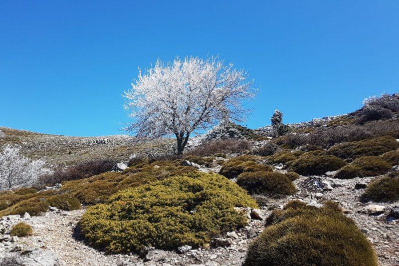
In the areas of low altitude and greater thermal influence, we find the thermo-mediterranean floor. Here the most heat-adapted species dominate, such as holm oak and cork oak groves, together with a mosaic of scrubland such as kermes oak and mastic trees.
As we gain mid-mountain, we enter the mesomediterranean floor, where temperatures are more moderate. This is the domain of sclerophyllous forests such as dense holm oaks and mixed forests with gall oaks.
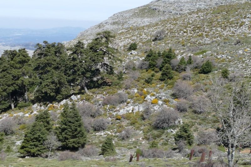
It is in the next step, the high Mediterranean mountain, where the supra- and oromediterranean floors are developed. Here, in the

Finally, in the most extreme areas of the oromediterranean floor, where the climate prevents the growth of trees, the vegetation gives way to large areas of high mountain scrub, plants adapted to wind, snow and frost. The thorny cushion scrub stands out, where species such as the crossbush(Vella spinosa) and the blue broom(Erinacea anthyllis) stand out, forming compact cushions to protect themselves from the elements, and the creeping junipers, where the juniper and the juniper prostrate themselves on the ground.

El Pinsapo: woods of a survivor
The Spanish fir (Abies pinsapo), a species in danger of extinction, is the main protagonist of the park. It is a relict conifer of the great extensions of conifers of the Tertiary era, which survived the subsequent cycles of glaciation and warming and is now sheltered in these mountains. There are only three forests of Spanish firs in Andalusia, and the one that protects this park, sheltered by the north face and the orography, houses the most extensive mass, with more than 850 hectares, with some of the oldest and most majestic trees, which adopt candelabra shapes, such as the Pinsapo de La Escalereta.
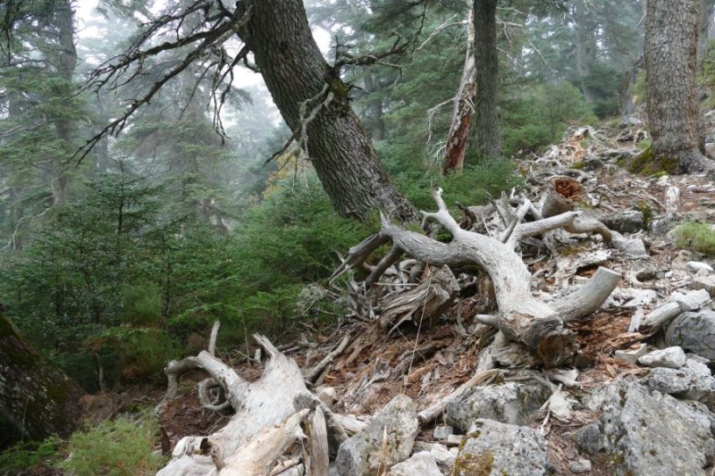
The Pinsapar de Yunquera and Cañada del Cuerno are characterized by a closed and perennial canopy that significantly limits the entry of light to the understory. This scarce luminosity, together with the high environmental humidity, favors the development of bryophytes (mosses and liverworts) that extensively cover the ground and fallen trunks.
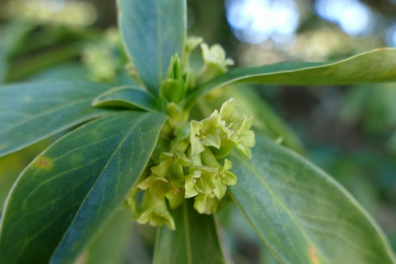
Under this shady and humid environment thrive nemoral species such as the durillo (Daphne laureola), the ryegrass(Helleborus foetidus) and the peony (Paeonia coriacea). The structure and microclimate of these forests, analogous to those of the boreal fir forests, provide an optimal habitat for a specialized forest avifauna, among which the Red Crossbill (Loxia curvirostra), the BlueTit (Lophophanes cristatus) and the scarce Red Crossbill(Phoenicurus phoenicurus) stand out.
The high mountain Quejigal

Above 1,600 meters of altitude, the Quejigal de Tolox extends, a unique forest formation dominated by Quercus faginea subsp. alpestris, ecotype adapted to the high mountain known as quejigo de montaña, or Boissier. These are communal forests that have been exploited since time immemorial by grazing and charcoal burning, uses that have limited natural regeneration and have favored the formation of a very clear forest. The resulting landscape is that of a high mountain pasture, where centuries-old gall oaks, stunted and twisted, are scattered over extensive thickets and pastures.
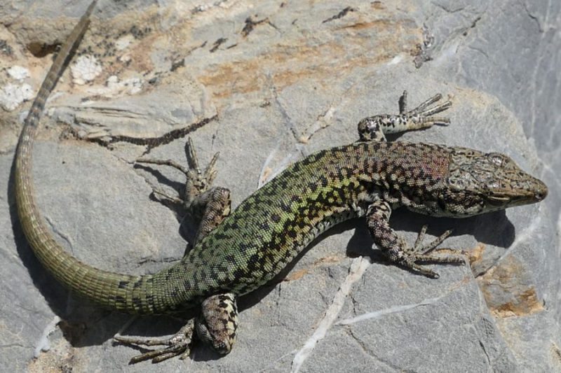
Isolated individuals of mustard (Sorbus aria), Granada maple(Acer granatense) and yew (Taxus baccata) are found, while the herbaceous undergrowth is home to species adapted to cold and grazing, such as Poa bulbosa. This community constitutes the highest altitude deciduous forest in the Iberian Peninsula on limestone substrate and a climatic refuge for “northern” species, which gives it an incalculable biogeographical and scientific value.
Plant diversity hotspot
The Sierras Beticas, which record up to 45% of the Iberian vascular flora and one of the highest rates of plant endemism in Europe, function as a true biogeographic “island-mountain”(Pugnaire et al. 2024). This condition of isolated enclave is due to the convergence of several factors over millions of years: its physical separation from the African and European continental masses (-8 to -6.5 MºA), the creation of a high mountain climate markedly differentiated from the surrounding environment, and its crucial role as a glacial refuge during the Quaternary glaciations. This prolonged isolation has led to a remarkable adaptive radiation, particularly visible in the specialized flora that colonizes its extensive limestone substrates.
The National Park is a hot spot of botanical diversity in the Mediterranean basin, with about 1,300 inventoried species. Among the most outstanding endemisms of the limestones and dolomites are
Karstic landscape: chasms and sinkholes
The Sierra de las Nieves is one of the most important karst in southern Europe. The action of water on limestone and dolomite over millions of years has created a fascinating subway world and a characteristic surface relief. Recently, a physical connection between hitherto isolated chasms has been discovered, and Nevero-Aire has been recognized as the largest subway complex in Andalusia.
Outstanding localities. Sima GESM: With -1,101 meters, it is one of the deepest caves in the world, a paradise for speleology. Hoyos del Pilar: A spectacular set of sinkholes and lapiaces (grooves in the rock) that form a mineral landscape on the surface. Aquifers and springs: This karst system acts like a giant sponge, giving rise to important springs of rivers such as the Verde or the Guadalevín.
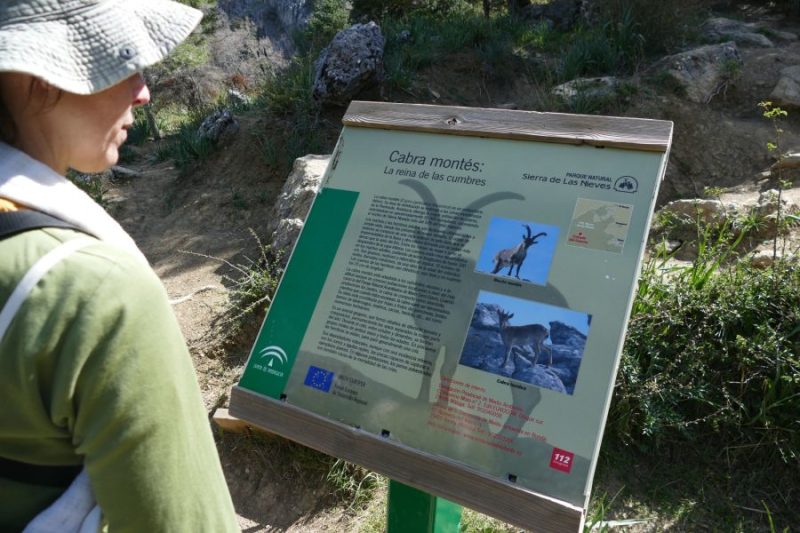
The most emblematic fauna of the park
The sky is the domain of the large birds of prey, Bonelli’s Eagle, Bonelli ‘s Eagle, Bonelli ‘s Eagle and Griffon vulture, which use the area as a breeding area, and the Peregrine falcon. The sighting of these birds is frequent in the cliffs and peaks.
At higher elevations, alpine grasslands and crags provide habitat for species such as the Blackbird (Ring Ouzel (Turdus torquatus), Common Rock Thrush (Monticola saxatilis) and Northern Wheatear (Oenanthe oenanthe), as well as other turdids, especially abundant during periods of migratory passage.
Mountain goat (Capra pyrenaica hispanica): It is the most emblematic mammal. It is observed with relative ease in the rocky areas of Sierra Blanquilla or on the stony slopes of Sierra Real. At dawn and dusk are the best times.
The best-preserved rivers that descend south towards the Costa del Sol are home to a rich and unique aquatic biodiversity. In its oxygenated waters persist vital populations of endemic and endangered fish, such as the Málaga chub (Squalius malacitanus) and the Freshwater blenny (Salaria fluviatilis), the latter listed as endangered, as well as its main predator, the otter (Lutra lutra). Among the invertebrates, there is an exceptional community of odonates (dragonflies and damselflies), where species of high conservation value coexist, such as the spectacular Splendid cruiser (Macromia splendens), the Oxygastra (Oxygastra curtisii) and the Graslin’s sandpiper (Gomphus graslinii), and others of African origin recently incorporated into the European fauna. This faunal mix makes these watercourses authentic biological corridors of international importance.
Cultural values of the park
The Sierra de las Nieves is also a cultural landscape shaped by humans over the millennia. Transhumance, charcoal mining, snow extraction (which gives its name to the sierra) and mountain agriculture have left their mark:
Ethnographic heritage: Neveros (snow pits), coal ovens, farmhouses and threshing floors dot the territory.
Traditional architecture: The villages in the area, with their narrow white streets, preserve a rich heritage.
Knowledge and crafts: Beekeeping, chestnut farming and artisanal cheese and sausage making are living traditions.

Sierra de las Nieves: Guide for Hiking and Nature Observation
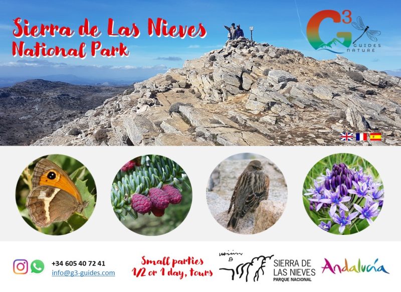
We will focus on the western area of the park, one of the most accessible and richest, taking as a reference the recreational area of Los Quejigales, accessible by a forest trail after a 30-minute walk from the surroundings of Venta La Laja Conejeras.
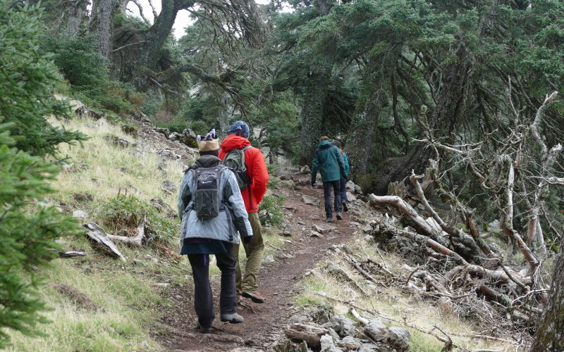
Hiking: route through the Pinsapar of Yunquera
- Description: A circular route that penetrates into the heart of one of the most extensive and well-preserved pinsapo forests. The atmosphere is humid and fresh, with straight trunks rising towards a closed canopy. It is ideal for botanical observation (mosses, lichens, ferns) and to enjoy the resounding silence of the forest.
- Starting point: Los Quejigales recreational area.
- Difficulty: Medium.
- Distance and duration: Approx. 10-12 km (4-5 hours).
- Recommended season: Spring (flowering) and autumn (colors).
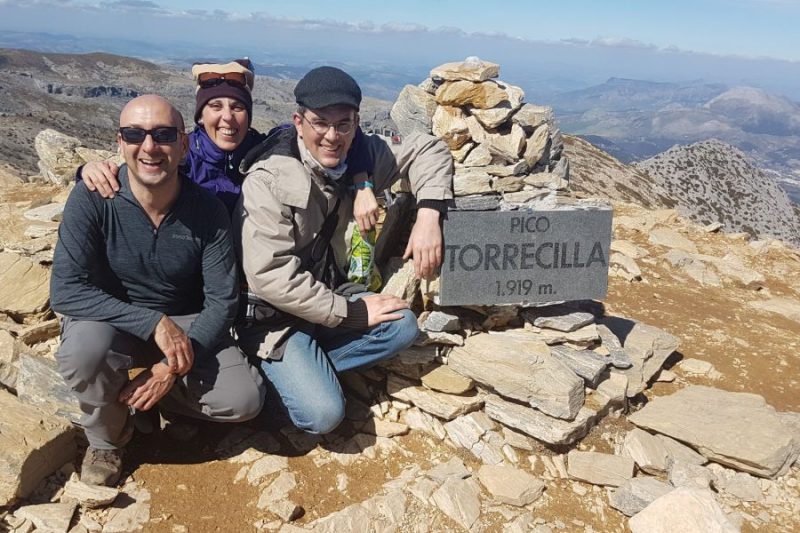
Ascent to Torrecilla Peak (1,919 m)
- Description: The highest summit in the western half of Andalusia. The most classic route starts from Los Quejigales, crossing first the spectacular Quejigal de Tolox and then the high mountain pastures and scrubland. The views from the summit are panoramic: to the north, the Ronda plateau; to the south, the Mediterranean on clear days.
- Starting point: Los Quejigales recreational area.
- Difficulty: Medium-High (due to slope, not technique).
- Elevation gain: +650 m.
- Distance and duration: Approx. 12 km round trip (5-6 hours).
- Recommended season: May to October. In winter, there may be snow and ice, requiring specific equipment and experience.
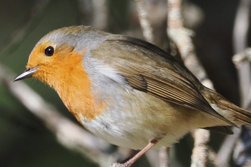
Nature Observation
- Sunrise/Sunset: The Mirador de Luis Ceballos (near Los Quejigales) or the vicinity of Refugio de Juanar offer spectacular panoramas in the golden light.
- Botanical photography: The pinsapares for forest details; the summit grasslands in spring for flowers; the lapiaz of Los Hoyos for abstract geomorphological landscapes.
- Wildlife sighting: Mountain goats: Stony slopes of Sierra Blanquilla and Sierra Real at dawn. Birds of prey: Gliding over the cliffs of Tajo de la Caina or in the vicinity of Pico Torrecilla. Water points: Watering holes and streams at dusk can attract wildlife.
Practical information about the national park
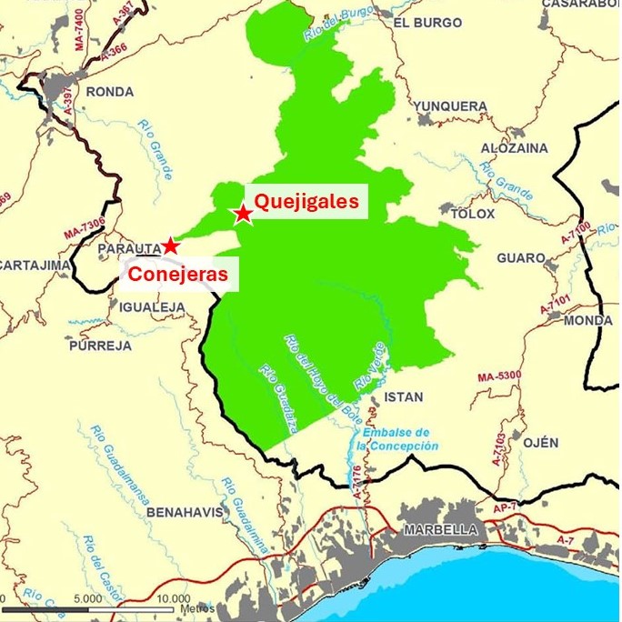
Location in the Province of Malaga and Gateway Towns
The park is located in the western sector of the province of Málaga. The
How to get there by car: access from the Costa del Sol, Ronda and Malaga city.
From Málaga/Costa del Sol: Highway A-357 to Campillos, then A-367 (Carretera de Ronda) to Yunquera, El Burgo or Ronda. From the coast (Marbella), the A-397 (Carretera de Ronda) is the most direct route.
From Ronda: By the A-366 road towards El Burgo and Yunquera, or by the MA-540 towards Los Quejigales.
Access to Los Quejigales: From Ronda, take the MA-540 (towards Igualeja) and turn off on a paved forest road (signposted) to the recreational area.
Public transportation and logistics options
Public transportation is limited. There are buses that connect Malaga with Ronda, and from Ronda with some towns like Yunquera or El Burgo, but the schedules are reduced, especially on weekends.
Where to Sleep: rural lodging in the park’s villages
- Ronda: It offers the greatest variety (hotels, hostels, apartments). Good base for its tourist offer.
- Tolox and Yunquera: Charming white villages with authentic rural houses. Ideal for a more immersive experience and closer to the routes.
- El Burgo and Parauta: Small and quiet, with some rural lodging options.
- Benahavís and Istán: Closer to the coast, they offer a combination of nature and proximity to beach services.
Visitor centers and information points
- Conejeras Visitor Center is under construction.
- Los Quejigales: next to the recreational area, a rural house will be opened soon.
- Ronda National Park offices are under construction.
Gastronomy and local products
Do not miss the honey from the mountains, the artisan goat and sheep cheese, the chestnuts (especially in autumn), the Iberian pork sausages.
When to Go: the best time for hiking and observation
- Spring (April-June): The most colorful season. Flowers, water in the streams, pleasant temperatures.
- Autumn (September-November): Golden colors in the forests, stable weather, ideal for hiking.
- Summer: Only recommended for very early routes, at high altitudes and with heat forecast. Plenty of water and sun protection.
- Winter: The peaks can be snowy, offering a magical but demanding landscape. Medium and low mountain routes are accessible.
Basic standards and special permits
- General rules: Drive only on authorized trails, do not make fires, do not leave garbage, do not disturb wildlife, do not collect plants or minerals.
- Special permits: Access to some areas of very sensitive pinsapares (such as the Pinsapar de las Escaleretas) requires prior permission managed through the Visitor Center of La Algaba. The main routes (Torrecilla, Quejigales) do not require it.
- Free camping: Prohibited inside the National Park. Only in authorized camping areas outside its boundaries.
Recommended equipment and mountain safety
- Footwear: Mountain boots with good soles.
- Clothing: Technical and layered (long sleeves for sun protection and brambles). Raincoat essential, changeable weather.
- Food and water: Minimum 2 liters of water per person (fountains are not always safe). Nuts, snacks, sandwiches.
- Others: Backpack, hat/sunglasses, sunscreen, walking sticks (very useful), physical map/GPS (mobile coverage fails), basic first aid kit, whistle.
- Safety: Inform someone of your route. Check the weather forecast. Do not underestimate distances or slopes. In case of emergency, call 112.
Context and conservation: a park with a history of the future
The protection of the Sierra de las Nieves has a long history, with petitions dating back to the 19th century. It was declared a Natural Park in 1989, a Biosphere Reserve by UNESCO in 1995 and integrated into the Intercontinental Reserve of the Mediterranean in 2006. Its elevation to National Park in 2021 is the highest recognition and entails greater resources and a stricter protection framework. This status seeks to ensure the conservation of its unique values and promote a sustainable tourism model that is compatible with the protection and economically benefits the people in its area of socioeconomic influence. As a visitor, your responsible attitude is a fundamental part of this model.
To highlight the areas of public ownership, shared grazing areas, whose vocation is undoubtedly the protection of the Mediterranean mountain and its traditional uses.
Sierra de Las Nieves was a little known mountain. At just over 20,000 ha (200 km²), it covers a modest area compared to its Andalusian counterparts. Its nomination was motivated by its rich flora and geomorphology, subjects that generally attract less public attention than the charismatic vertebrates. In addition, Sierra de Grazalema hosts the most famous Spanish fir forest in Andalusia and “steals”, to some extent, the limelight. In the same line, La Maroma (2 069 meters) is the summit of the province of Malaga and “shrinks” our mountain. Regarding the toponomy, it should be noted that most of the Andalusian natural parks are named after a village that focuses the attention and promotion. Finally, for a long time, the tourist industry literally devastated the coast and abandoned the interior, whose villages continue to lose population. For all these reasons, the recognition of Sierra de Las Nieves has been slow… although fortunately, it has been unstoppable.
Until recently, the collective unconscious relegated Sierra de Las Nieves to a second-rate park. We can say that this perception has changed a lot in recent years thanks to a campaign that has transformed the modest Natural Park into a striking
Key Data
| DATO | INFORMATION |
|---|---|
| Official Name | Sierra de las Nieves National Park |
| Date of declaration PN | 2021 |
| Surface | 22,983.73 ha |
| Province | Malaga (Andalusia) |
| Maximum altitude | Torrecilla Peak (1,919 m) |
| Previous figures | Natural Park (1989), Biosphere Reserve (1995) |
| Principal value | Pinsapares, Quejigal de altura, karst, periodotitas |
| Main towns | Ronda, Tolox, Yunquera, El Burgo, Parauta |
| Visitor Center | Under construction |
| Best hiking season | Spring and Fall |
Active Visitor Frequently Asked Questions (FAQ)
Do I need permission for all the routes and to see the pinsapos?
No. The most popular and marked routes do not require a permit. The permit is only for access to very specific and delicate stands of pinsapo, which are clearly marked. Ask for more information at the Visitor’s Center.
Is the route to Torrecilla for beginners and in winter?
G3-guides: It is not a route for absolute beginners. It requires a good physical shape due to the accumulated elevation gain and the distance. In summer, the heat can be a limiting factor. In winter, the presence of snow and ice makes it a winter mountain route, which requires adequate equipment (crampons, ice axe in some cases) and experience.
Where am I most likely to see mountain goats?
G3-guides: On the rocky and stony slopes of Sierra Blanquilla (north sector) and Sierra Real (south sector). The best times are sunrise and sunset. Use binoculars and keep your distance and silence.
Are there drinking water fountains on the trails?
G3-guides: Cannot be guaranteed. Although there are some springs (such as in the area of Los Quejigales), they are not always functioning or safe to drink untreated. It is essential to carry all the water you need from the beginning of the route.
Can we do a circular route combining pinsapos and summit?
G3-guides: Yes, it is possible to design circular routes from Los Quejigales that pass through the Pinsapar de la Cañada del Cuerno and then ascend to Torrecilla by a variant, descending later by the ridge or by another gully. These are long and demanding routes (more than 6 hours), which require good planning.
Leave a Reply