

HUELVA, SEVILLA and CÁDIZ – The most prestigious wetland in Western Europe.


Doñana is one of the most extensive and mythical natural jewels of Europe. This vast wetland, located in the southwest of Andalusia, is distributed mainly by the province of Huelva, extending also by territories of Seville and Cadiz. It protects more than 120,000 hectares, of which about 54,000 constitute the National Park. Its true ecological dimension is understood when considering the entire wetland system associated with the Guadalquivir estuary south of Seville.
Doñana is the transition zone between the Guadalquivir Depression and the Atlantic Ocean: the final mouth of the “Great River”, the living frontier where land and sea dialogue. This vast marshy territory was, in origin, a large marine gulf that, millennium after millennium, was filled with sediments dragged by the river, until it formed an immense shallow lake. This ancient lake was, according to tradition, the cradle of the civilization of Tartessos. Subsequently, the accelerated erosion by Roman agriculture throughout the valley ended up filling and closing this system, giving rise to the extensive marshes that we know today.
Since the Middle Ages and until its protection in 1969, these lands were an exclusive hunting ground for the nobility, especially for the House of Medina Sidonia. Scientific attention came in the 19th century, when naturalists such as the Spaniard Antonio Machado y Núñez, followed by the British Abel Chapman and Walter Buck, revealed to the world its exceptional ornithological value. In the 20th century, post-war agricultural transformation projects unleashed a forceful international conservationist campaign, which culminated in the declaration of the National Park.


Doñana is a unique mosaic of ecosystems. It is home to a dazzling variety of wetlands: the Guadalquivir River and its estuary, marshes and rice fields flooded in complementary seasons, gallery forests and hundreds of lagoons and temporary ponds. In contrast, its terrestrial environments stand out for their aridity, on sandy substrates: here we find the most important active dune system in Europe, together with imposing coastal fossil dunes (the Asperillo) and an extensive blanket of fossilized inland dunes. The landscape is completed by extensive pine groves (Pinus pinea), wild olive groves (Olea europaea sylvestris), a cork oak grove (Quercus suber) with difficult regeneration and a varied Mediterranean scrub.
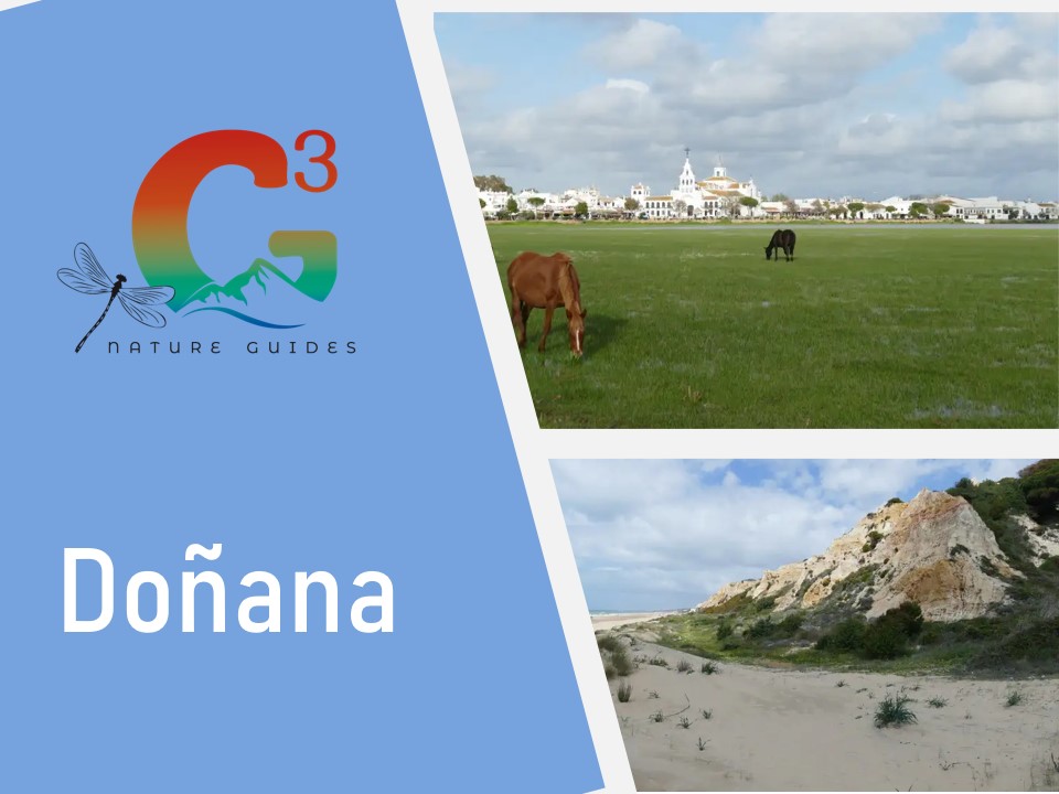
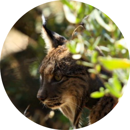
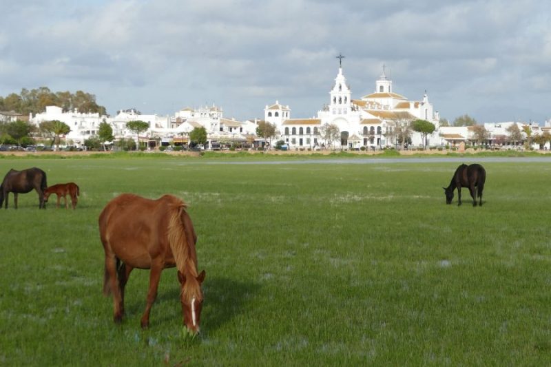
Doñana’s fame is based, above all, on its extraordinary birdlife. More than 300 species can be observed throughout the year. The park is a winter refuge for more than 200,000 waterfowl and is home to a historic population of Spanish Imperial Eagle(Aquila adalberti). The largest arboreal colony of White Stork(Ciconia ciconia) in Europe nests here. Its flora exceeds 900 species. And, of course, it remains the stronghold of the Iberian lynx(Lynx pardinus), its living emblem. It is easier to spot the ancestral marsh horses and reeds grazing near El Rocío.

Doñana Natural Area, the mini-guide
Doñana, an immense protected area… as big as twice Madrid, for example. In this mini-guide we indicate the main places of interest worth visiting to know the park, grouped into five geographical areas, following the cardinal points and above all the possibilities of access.
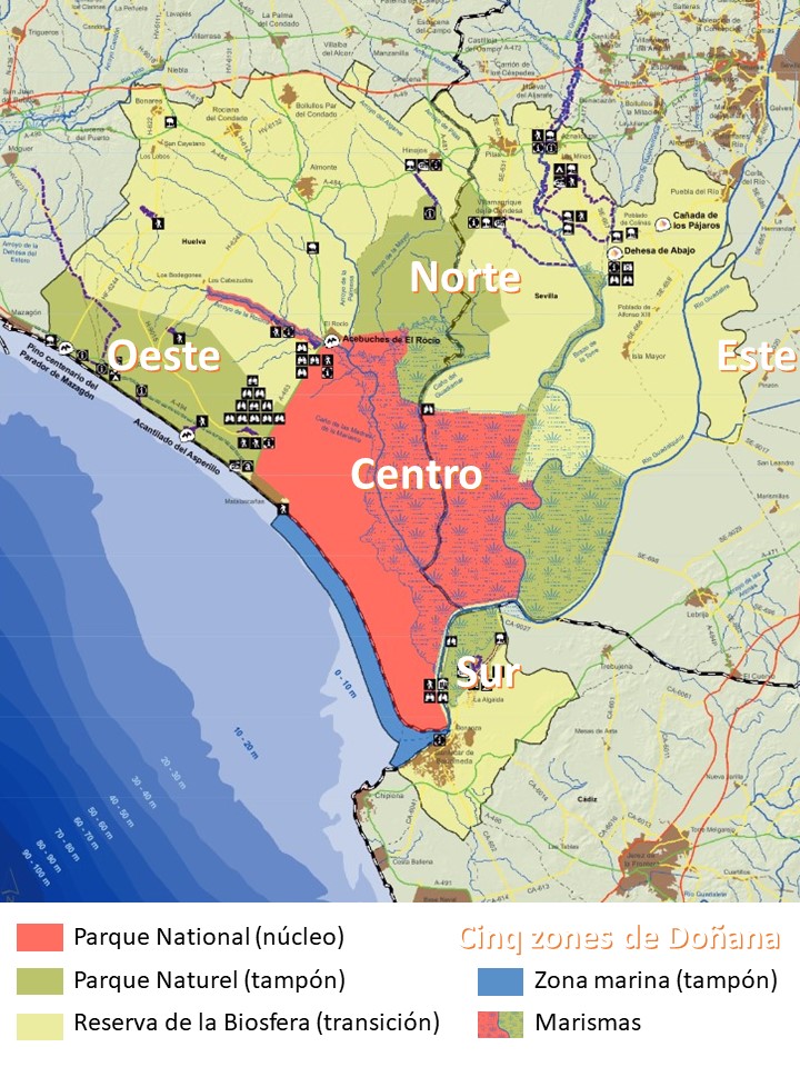
The heart of Doñana (technically, Doñana Natural Space) is none other than the Doñana National Park, an almost impenetrable area of 543 km² surrounded by perimeter buffer zones (Pre-park; natural parks) that house the facilities accessible to visitors. The land of the Doñana Biological Reserve is used for scientific research, mainly by the Doñana Biological Station.

The heart of the marshes: El Rocío and the Doñana Biological Reserve.
El Rocío is the spiritual and ecological center of Doñana, an essential stop. This village, with sandy streets and Sevillian air, is built around the Chapel of the Virgen del Rocio. In front of it, the Marismas de La Madre marshes, one of the best enclaves for bird watching in Europe, spread out. The village comes to life during the multitudinous Pentecost Pilgrimage and the Saca de las Yeguas (June 26), when the ranchers (the ‘yegüerizos’) lead the marismeños horses from the marshes to Almonte.
El Rocío: la Madre de las Marismas
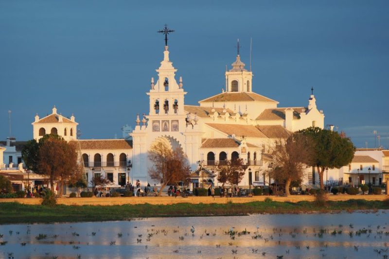
One of the most iconic landscapes of the park, whose importance is reflected even in the multitude of its place names: Charco de La Boca, Marisma del Rocío, Marisma de La Madre, Madre de Las Marismas… The village of El Rocío lives devoted equally to the devotion of the Blanca Paloma and the reverent contemplation of the birds. This vast wetland, beating heart of Doñana, is formed mainly by the confluence of the streams of La Rocina and El Partido, which provide the fresh waters that feed it. Its dynamics is a wonder of nature: in autumn 2025, I was able to witness how an exceptional rainfall of more than 120 liters in one day completely transformed the marsh, flooding overnight a plain that hours before appeared completely dry. At the end of the Mirador promenade, where the view embraces this changing spectacle, is the ornithological center of SEO/Birdlife, dedicated to the study and conservation of birdlife.
La Rocina – El Acebrón
The stream of La Rocina, the main tributary of the marsh, collects the rainwater that filters through the immense dune mantle of El Abalario, in western Doñana. A short distance from El Rocío, two visitor centers offer complementary experiences to delve into this unique ecosystem: the visitor center of La Rocina, with its discreet camouflaged observatories that allow sightings of the birdlife of Charco de la Boca; and the visitor center of El Acebrón, whose path winds through the shade of a dense and cool gallery forest, on a walkway that allows you to explore a normally impenetrable habitat. One of our favorite sites.
Acebuches del Rocío

In the Plaza del Acebuchal stands this Natural Monument: a dozen wild olive trees, wild olives (Olea europaea var. sylvestris ), centenarians, the last witnesses of an ancient Mediterranean forest adapted to heat and drought.
Centro de visitantes El Acebuche
It is the park’s main reception center. From here, several trails lead to bird observatories that once overlooked freshwater lagoons. Today, the reality is more somber: the continuous lowering of the water table has left these normally dry lagoons, and their beds, once aquatic, have been colonized by scrub, silent testimony to the profound alteration of the water cycle. Despite this panorama, the center maintains its attractiveness for families with a store selling quality products and houses an extensive acclimatization cage where visitors can observe Iberian lynx specimens removed from the breeding program.
El Puntal – Palacio de Doñana

Access to the heart of the National Park, a vast area of integral reserve, is strictly regulated and is only possible through official guided tours in 4×4 minibuses, which depart from the El Acebuche Visitor Center. This excursion, which lasts several hours, allows visitors to discover the iconic and restricted landscapes of Doñana, although fauna and flora observations are therefore limited. The trail winds through an imposing tongue of shifting dunes, a natural living sand dyke that contains and protects the vast inland marshes. The transition is dramatic: just at the line where the last dune merges with the wet silt, the grasslands of La Vera emerge and, in the distance, the forest of cork oaks whose canopy supports a bustling colony of colonial birds, La Pajarera, can be seen. The return is made by the beach of Castillo – Torre Great Tit.
Northern Doñana: birdwatching spots within reach of Seville
To the southwest of Seville, the riverside towns of Coria and La Puebla del Río mark the entrance to the marshes of the Ajo Guadalquivir. The rice fields of Isla Mayor, transformed in the twentieth century, extend into the horizon to infinity and contrast with the neighboring reliefs. The pine forests and Mediterranean forests of the pre-park are an excellent habitat for the lynx.
Dehesa de Abajo
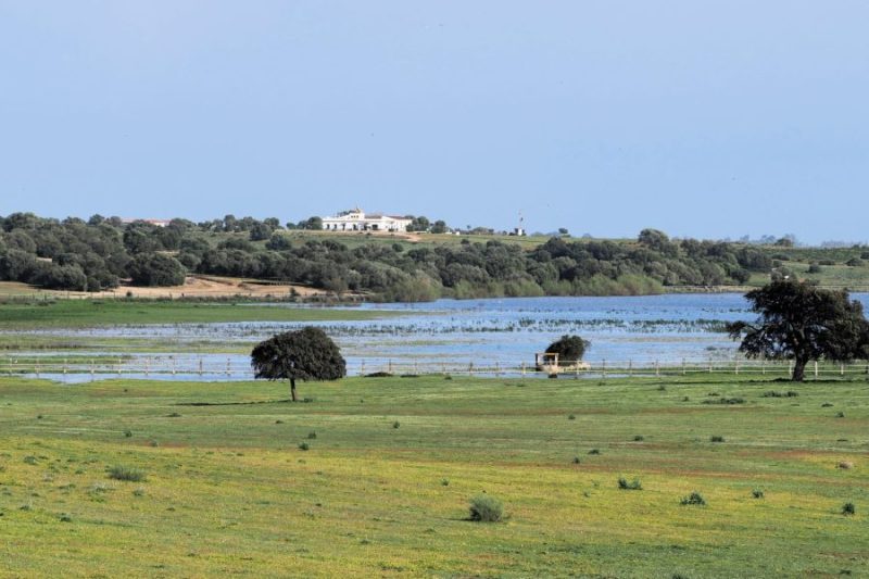
La Dehesa de Abajo is a Concerted Natural Reserve that constitutes a rare and valuable example of how to harmonize nature tourism with sustainable private management. Its success lies in its privileged location: a hill crowned by holm oaks and wild olive trees that overlooks the marshy plain. This promontory is home to the largest natural colony of white storks in Europe that nest in trees, a unique spectacle where hundreds of nests populate the treetops. To complete this mosaic of biodiversity, a deep semi-natural lagoon attracts a great variety of aquatic birds, from ducks to Greater Flamingoes, making this space an exceptional ornithological enclave. The time of the visit determines the choice of the point of view over the lagoon with the observatories facing west.
Centro de Interpretación José Valverde
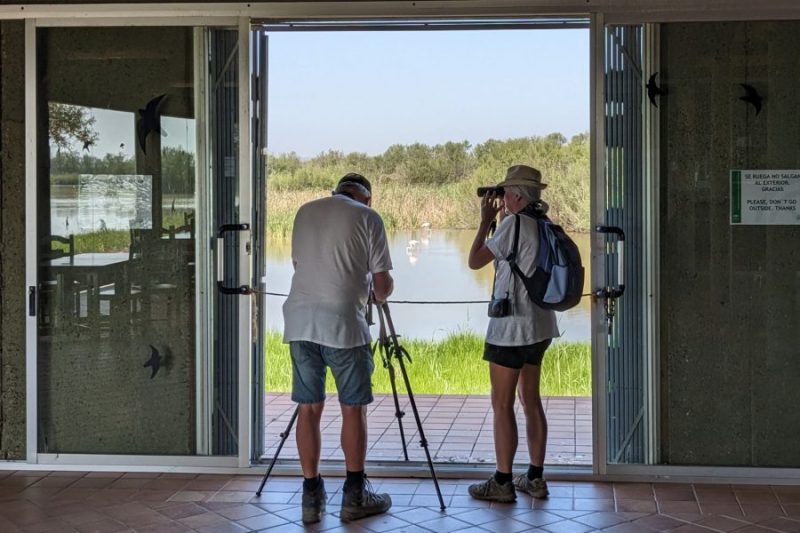
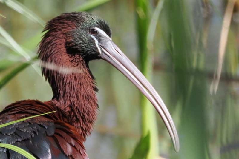
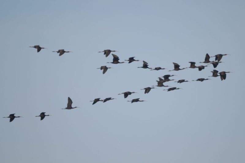
It is undoubtedly one of the most emblematic and productive places for ornithology in Doñana. Access, however, is an experience in itself: a completely isolated dirt track that winds for miles through a vast agricultural landscape before reaching, in a long circular route, the most remote and wild edge of the national park. There, next to an isolated lagoon of permanent water, stands the unique José Antonio Valverde Interpretive Center with its bustling breeding colony of hundreds of herons, egrets and Glossy Ibis. Beyond the center, the flooded marshes unfold with enclaves such as Meadow Brown del Grey Wolf and Cerrado Garrido. The exploration continues along an elevated track that runs along the Caño del Guadiamar, the old and meandering natural riverbed. This circuit, suspended between the agricultural area and the integral reserve, offers a unique perspective for the observation of waterfowl and birds of prey in a landscape of infinite horizons.
Pinares de Aznalcázar
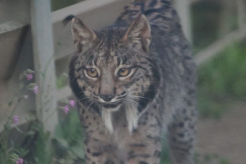
To the north of the Doñana Natural Area, extends one of the most valuable and accessible forest formations of the pre-park: the Pinares de Aznalcázar. This extensive Mediterranean forest, dominated by stone pine (Pinus pinea) and dotted with wild olive trees and noble scrub, plays a crucial ecological role as a buffer zone and biological corridor. The undergrowth, composed of mastic, jaguar and rosemary. These pine forests are an essential habitat for the Iberian lynx (Lynx pardinus) thanks to the maintenance of localized populations of wild rabbits (Oryctolagus cuniculus).
Isla Mayor
The area known as ‘Isla Mayor’ -the largest river island in Spain- is bounded to the east by the main channel of the Guadalquivir (Brazo de Enmedio) and to the west by the Brazo de La Torre, an old channel today fed by the waters of the Guadiamar river. This territory is, in essence, an artificial ocean of rice fields covering about 40,000 hectares, a humid plain created in the mid-twentieth century by draining the original marshes, a pharaonic work of harsh conditions in which political prisoners and settlers participated. This horizontal, labyrinthine landscape rose to fame as the setting for the film ‘La isla mínima’ (2014). At the southern tip of the island, is the Finca Veta La Palma, a property of 7,600 ha that was dedicated to extensive aquaculture ponds and recently acquired by the Junta de Andalucía (72.6 M€). It has become a refuge for thousands of waterfowl.
Cañada de los Pájaros
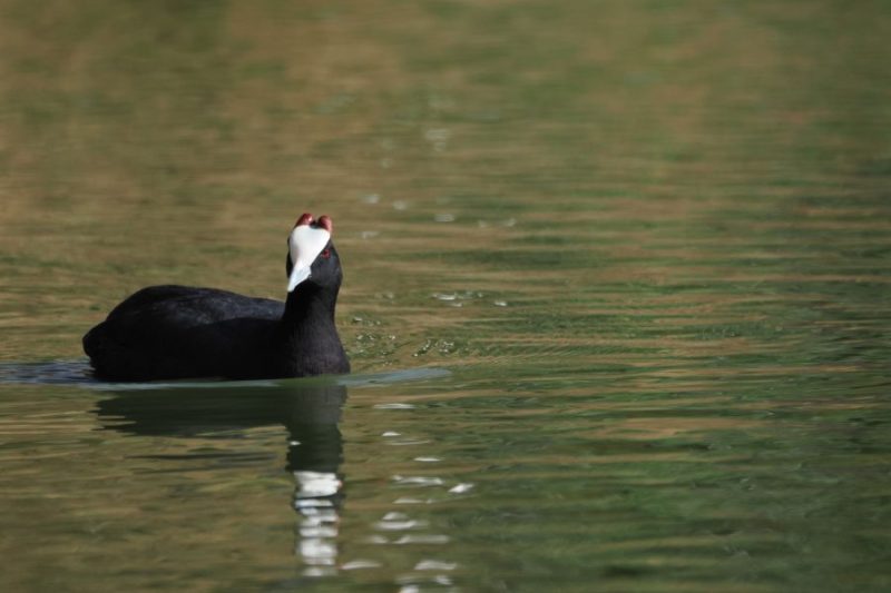
Concerted Natural Reserve. La Cañada de los Pájaros is an atypical and pioneering private facility for the restoration of an old gravel pit into a specialized refuge for aquatic birdlife. You can observe a collection of wild species in captivity and wild birds that visit the permanent lagoon. La Cañada de los Pájaros is a Concerted Natural Reserve and a pioneering ecological restoration project. This atypical private facility transformed a former gravel pit into a thriving specialized refuge for aquatic avifauna. It combines ex-situ conservation with wildlife enhancement. It maintains a collection of semi-free-ranging wildlife species, mainly waterfowl that are difficult to observe in their natural environment, which serve an educational function. On the other hand, the permanent lagoon and the reed beds serve as a feeding, resting and breeding area for wild birds.

Eastern Doñana: the polders of the Guadalquivir transformed
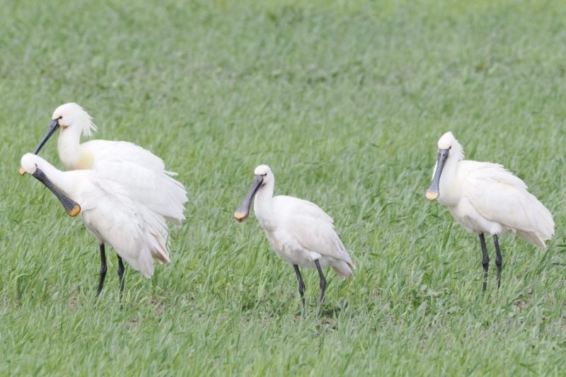
Here is an area that, despite not being within the legal boundaries of the Natural Area is one of the best enclaves of the whole environment doñanero for ornithology, with concentrations of tens of thousands of birds. To the west of Los Palacios and Villafranca extends the vast polder of the left bank of the Guadalquivir, a transformed marsh of more than 40,000 hectares dedicated to intensive agriculture. In its center runs the old eastern course of the river, known as the Brazo del Este, surrounded by a labyrinth of rectilinear canals, sluice gates and service roads that channel the waters of the tributaries of the basin. The paradox and the value of this place reside precisely in that tension between the artificial and the wild. The enormous extensions of cultivation, the flooded fallows and the canals themselves generate a food supply that massively attracts wildlife. The result is a unique sensation: observing impressive flocks of Spoonbills, Glossy Ibis, gulls, waders and geese flying over or resting in an environment that looks more like a hydraulic engineering than a natural refuge. It is the demonstration that biodiversity can thrive, unexpectedly, in the interstices of humanized landscapes.
Los Palacios Polder
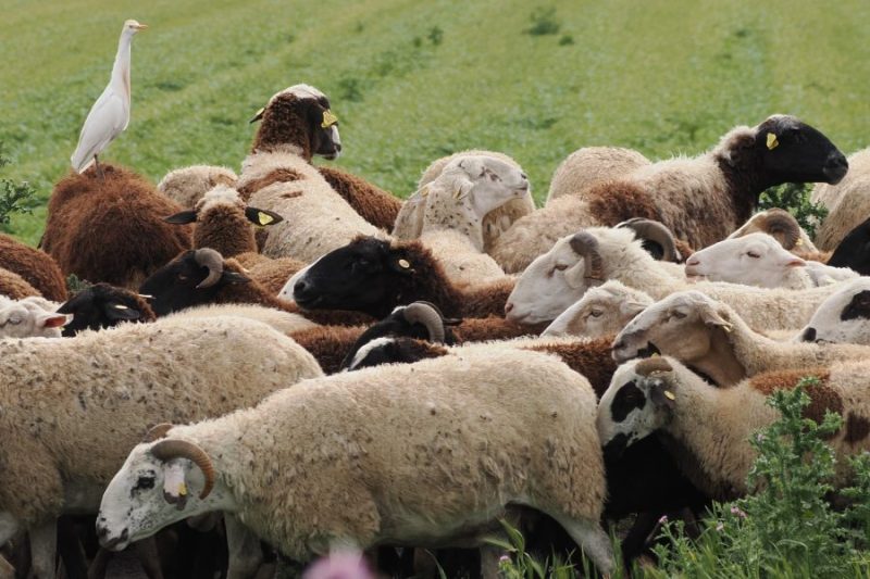
To access the Brazo del Este it is necessary to enter the vast agricultural plain of the polder of Los Palacios y Villafranca. This landscape, completely shaped by human hands, becomes an improvised and vital restaurant for birds. Large wading birds (ibis, storks) and terrestrial lymicolous birds are distributed according to their diet, and in a somewhat mysterious way, in specific plots, most of the time recently plowed and marshy. The key to observation is to understand this “trophic mosaic”: the avifauna is distributed in an almost methodical way according to the availability of food offered by each type of tillage and level of flooding of the infinite plots. The same field can be full of life one week and empty the next, after a tillage or a change in the water level, in a dynamic back-and-forth between agricultural activity and wildlife.
El Brazo del Este
In the heart of the agricultural polder is the Brazo del Este, declared a Natural Site, a protected area where the highest density and diversity of aquatic birdlife is concentrated. The wetland follows the sinuous and natural profile of the old Guadalquivir riverbed, known as the Madre Vieja. However, this organic layout is drastically cut by the “Muro de los Portugueses”, a straight line almost 10 kilometers long that acts as a gigantic dam. The result is a landscape of surreal geometric contrasts: the meandering curves of the fossilized river collide with the unyielding straightness of the dike, creating a mosaic of sheets of water, reeds and muddy plains. This peculiar structure, far from being an impediment, has created a variety of aquatic habitats (shallow, deep, flowing and stagnant waters) that explain its extraordinary ability to attract and sustain birdlife.
Dehesa La Atalaya
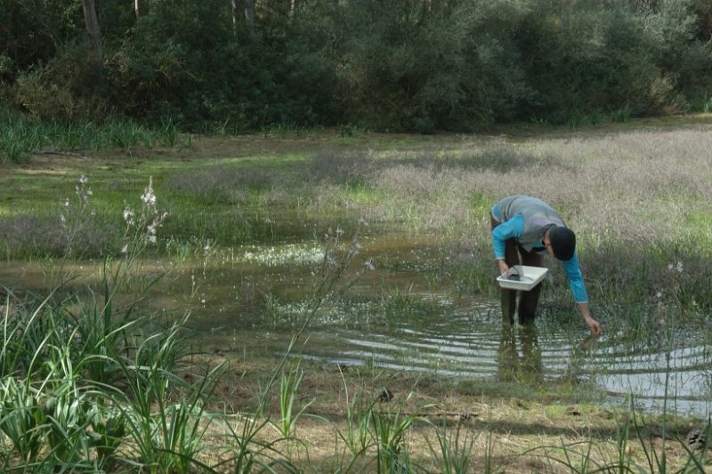
The Dehesa La Atalaya is a municipal public estate that exemplifies an integral management of the territory, combining traditional agricultural and livestock uses with a powerful vocation for environmental education and conservation. Its true ecological treasure, however, is subway and is revealed with the rains: it is one of the most important and biodiverse complexes of temporary Mediterranean ponds in Andalusia. They are home to an exceptional concentration of drought-adapted aquatic organisms, including large branchiopods – small primitive crustaceans often called “living fossils” – as well as a rich community of amphibians, insects and specialized flora. Each pond is a unique microcosm, making La Atalaya a place of the highest value for science and naturalist observation, and a crucial testimony to the fragility of temporary aquatic ecosystems.
Doñana Sur: on the way to Cádiz…
The southern flank of the Doñana Natural Area unfolds in the province of Cadiz, with the monumental Sanlúcar de Barrameda as its historical gateway. On this left bank of the river is located the part corresponding to the Doñana Natural Park, which offers an authentic and often more accessible experience of the essence of Doñana. Visiting this sector allows you to enjoy the “Doñana effect” in its Cadiz version: a rich birdlife and a complete representation of its emblematic habitats – pine forests, marshes, lagoons and vera – all without having to cross the Guadalquivir or go through the metropolitan area of Seville. It is also the only possible access to walk along the banks of the river in its estuarine section, which provides a unique and majestic perspective of the mouth of the river.
Sánlucar de Barrameda: the mouth of the river

From the promenade of Sanlúcar de Barrameda, one of the grandest views of Doñana can be seen: the majestic mouth of the Guadalquivir River merging with the Atlantic Ocean. This same place, now serene, was for centuries a fearsome and dangerous gateway for Spanish galleons laden with treasure, which faced here the last and treacherous stage before going up the river to Seville. Today, the gateway to the natural adventure is the modern Ice Factory Visitor Center. From its dock, a ferry service (provided by the company ‘Real Fernando’) allows you to cross the river by boat to enter directly into the area of moving dunes and pristine beaches of the National Park, offering a unique experience of connection between the historical and natural heritage.
Bonanza Salt Flats
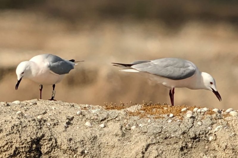
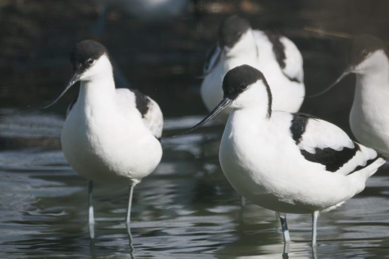
The Bonanza Salt Flats are the only active salt installations within the boundaries of the Doñana Natural Area. Their existence is possible thanks to the powerful tidal regime of the Atlantic, which has historically favored the development of this industry along the Andalusian coast, from the Bay of Cadiz to the Odiel Marshes. These salt marshes are not only a vestige of traditional economic activity; they constitute an artificial wetland of extraordinary ecological value. The crystallizers and estuaries, with their different levels of water and salinity, act as a magnet for birdlife. They host important concentrations of aquatic birds, which find food and rest here: flocks of waders such as Avocets and plovers patrol the shores, while the colorful Greater Flamingoes filter the water in the shallowest pools, creating an unforgettable color contrast against the white of the salt.
Laguna Tarelo y Pinar La Algaida
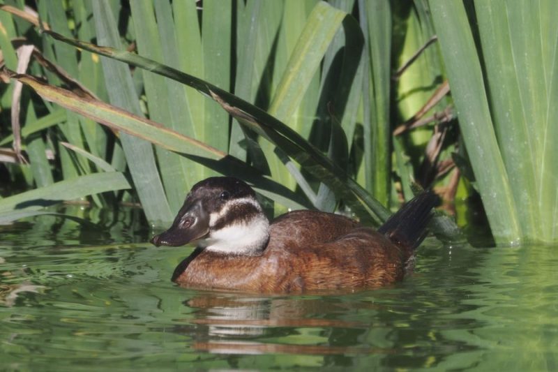
Opposite the brackish Salinas de Bonanza, the Tarelo Lagoon emerges as a permanent freshwater oasis, the result of the restoration of an old gravel pit. This anthropogenic origin has given rise to a perfect complementary habitat, which attracts a different avifauna to that of the salt flats. It is one of the best places in this area to observe the White headed Duck, a globally threatened diving duck, as well as other freshwater waterfowl such as Common Coots and Grebes. A short distance away, the Pinar de La Algaida pine forest extends about 700 hectares of the Pinus pinea (Pinus pinea) characteristic of Doñana. Under its canopy, protected by the shade, grow beautiful and well-preserved specimens of black juniper (Juniperus phoenicea), a typical species of sandy and saline soils that forms a unique mixed forest here. This set of lagoon and pine forest represents an ecological complex of great value, where the aquatic and forest ecosystems of the Doñana coastline alternate.
Marismas de Trebujena

The natural area of the Trebujena Marshes offers visitors a spectacular synthesis of the transitional landscapes of Doñana. From its trails and observatories you can see a changing mosaic of tidal marshes, halophytic plant meadows, natural brackish lagoons, restored gravel pits and the active banks of the Guadalquivir. This great diversity of habitats in a relatively compact area translates into an exceptionally rich and varied avifauna. But the real magnetism of the place is granted by its unique perspective: from here you have the most direct and extensive view to the opposite bank of the river, that inaccessible and mysterious territory that extends, wild and protected, along hundreds of square kilometers. Contemplating that line of forest and dune on the horizon, knowing that it is the very limit of the National Park, adds a deep sense of contemplation and respect for the preserved immensity.
Western Doñana: El Asperillo on the coast / El Abalario inland
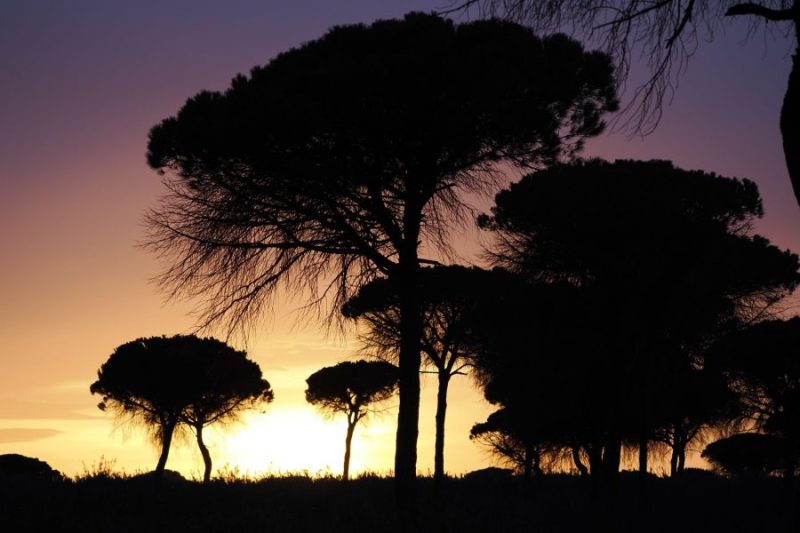
An impressive wildlife crossing bridge near El Acebuche announces the imminent arrival at the resort of Matalascañas and symbolically marks the passage along the coast of the Doñana Natural Area that stretches between the mouth of the river (to the east) and Mazagón (not far from Huelva). In the little visited western Doñana, a fossil dune, several kilometers long and culminating at more than 100 meters, runs along a preserved beach and dominates the pine forest of Abalario. Here you will find a multitude of temporary ponds greatly affected by the excessive extraction of water from Matalascañas and growers of strawberries and berries. Rare passages through the dune give access to the beach.

Playa de Castilla – Torre Carbonero
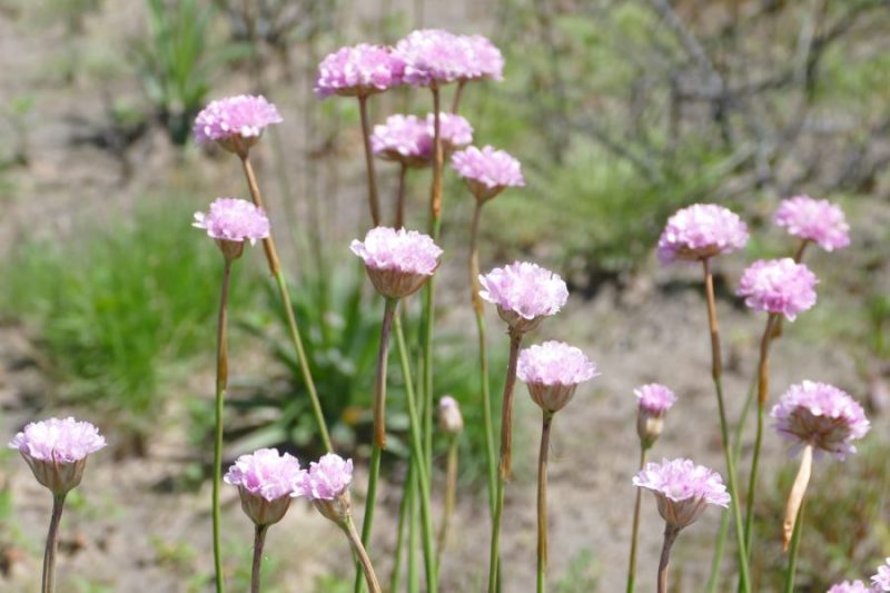
Little frequented by bathers, the beach stretches for more than twenty kilometers southeast of Matalascañas and is accessible on foot passing behind the big hotels. It is used by 4×4 vehicles visiting the Puntal on the way back. Wild littoral that shows all the dune fascias and hosts barron (Ammophila arenaria) in abundance and ancient watchtowers (Torre Great Tit).

Mazagón centennial pine tree
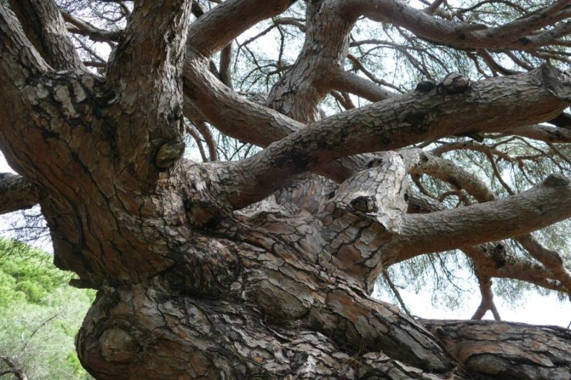
Natural Monument located next to the Parador de Mazagón: monumental specimen of stone pine (Pinus pinea) with an estimated age of 400 years. This tree is the dean of the great pine forest of Doñana, fruit of important forest plantations throughout the sector.

Cuesta Maneli
Wooden footbridge that allows crossing the fossil dune of Asperillo and access to the sea. Observation point over the pine forest of El Abalario and the Atlantic Ocean. Trail to visualize the effects of the 2017 fire.
El Asperillo Cliff

Natural Monument. A system of ‘fossil’ dunes that extends along the coast between Matalascañas and Mazagón (more than twenty kilometers). It is sand brought by the wind 15,000 years ago and compacted in the form of sandstone (not very compact sandy rock), today subjected to erosion phenomena and forming impressive coastal cliffs.
Recently a big storm has uncovered an impressive deposit of fossilized footprints on clays on the beach of Matalascañas. They can be observed in special conditions of low sea and when the currents remove the sand that is later deposited again. These fossils include human footprints of Neanderthals (106,000 years old) as well as numerous mammals, for example elephants (Palaeloxodon antiquus).
Ribetehilos peat bogs
Very little frequented route, close to the abandoned farmhouse of Abalario, which runs through several small connected lagoons, where organic matter accumulates, forming small Mediterranean peat bogs.
Laguna de Moguer

One of the many temporary Mediterranean ponds located in the immense pine forest that develops on the dune mantle of western Doñana (El Abalario). These ponds, which are highly dependent on rainfall, do not form every year and dry up at the end of spring.
Note: There are major threats to Doñana, the most important of which is the excessive extraction of water derived firstly from the large intensive strawberry crops that extend over more than 5,000 ha (add thousands of tons of plastic sheeting waste and inputs each year) and secondly from the human consumption of coastal urbanizations. The result is a decrease in the hydroperiod of a good number of lagoons and temporary ponds. Also mention the Aznalcollar disaster in 1998, with the dumping of mining waste in the Guadalmar, and the great forest fire of 2017 with 8 500 ha burned. Fortunately, the project of a coastal road intended to link Cadiz with Huelva crossing the heart of the national park – a latent threat for decades – seems to have been definitively dissipated, ensuring the preservation of the integrity and tranquility of this unspoiled coastline.
Leave a Reply